
General February 2025 Activity: A Broad Mix Of Tops And Weather
- bross

- Feb 28, 2025
- 4 min read
The month of February 2025 saw folk making many outings but not in a great deal of snow considering the time of year...but that didn’t dampen the fun!

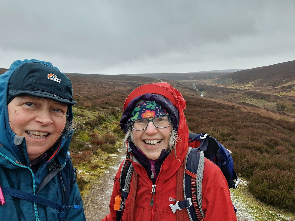
First up, a trip on 06/02/25 to the Scotland/England border, on the edge of the Northumberland National Park, to climb the Donald Windy Gyle, NT 85547 15219 and The Cheviot, NT 90907 20526. The route started at the beginning of the road leading to Cocklawfoot farm, NT 84002 19750, see; https://consumerplatform.ordnancesurvey.co.uk/route/25764209/250206--the-cheviot--fae-nt-84064-19742?lat=55.45626&lon=-2.22282&zoom=12.6512&style=Leisure&type=2d. Pic show AS taking a selfie with PF, GB, BR & IH acting as stage props.

Pic shows Cocklawfoot farm in the early morning frosty light.

On the shoulder of Windy Rig looking north.

Windy Gyle trig point.

…shall we get the maps out?

There followed an extensive march generally NE over The Cheviot Hills, facilitated greatly by the flagstone path. Pic taken at The Cheviot’s trig point looking NE.

…it has a considerable foundation!

On the way down from The Cheviot aided by the flagstones over the boggy ground.

Further down, IH set his camera set to look WNW from Auchope Cairn, catching BR, AS & IH. A guid day out covering 23.2km and 781m of ascent over 7:30hr.

On 09/02/25, MMcE & CS tackled Meikle Says Law (535m), NT 58121 61739, a wee hill but the highest hill in the Lammermuirs. Unfortunately, the weather much more dreich than advertised. Pic shows the cattle grid start along the 'Herring Road', near Faseny Cottage.

The Faseny Water.
Two (too) damp and chilled walkers.

Grouse footprints in the snow.

…this is what they came for – the view from the top.

Looking NW over glen to Harestone Hill (504m), NT 56806 62324. Going back down the same way completed a nice wee moorland walk, complete with stream crossings, some traversing of light snow and the sight of plenty wildlife.

Next up, on 14/02/25, IH & BR had a great day tramping a circuit starting from near Capplegill, NT 14490 09774, NNW up to Nether Coomb Craig, Swatte Fell, Falcon Craig, Hart Fell, Hartfell Rig, Under Saddle Yoke, Saddle Yoke, then south to road and car, see; https://consumerplatform.ordnancesurvey.co.uk/route/25767104/250214--hart-fell-horseshoe--fae-capplegill?lat=55.39343&lon=-3.38596&zoom=12.4217&style=Leisure&type=2d. Pic shows the view NNW from Swatte Fell to Hart Fell.

BR & IH at the Hart Fell trig point.

From the trig point looking east; left of pic is the snowy dome of White Coomb, then Carrifran Gans with it’s dark, steep western face then the twin bumps of Under Saddle Yoke and Saddle Yoke.

Pic taken from Redgill Craig looking WNW over to Hart Fell, centre pic.

Approaching the top of Under Saddle Yoke with Saddle Yoke on the right of pic.

IH on top of Under Saddle Yoke looking ENE towards Carrifran Gans, behind his shoulder and White Coomb centre pic.

…the only other hillwalker met that day. Overall, it was a tremendously satisfying day oot covering 14.8km, 978m of ascent in 6:30hr.

Three days later AS & PF went to do Corbett White Coomb, NT 16325 15103, and Donald Top Carrifran Gans, NT 15938 13886. Starting from The Grey Mare’s Tail carpark, NT 18585 14548, they took the path to Loch Skeen, then up Mid Craig, heading SW to the fence leading to White Coomb, then SW to Carrifran Gans, descending east to the forestry road, via tree stumps, moss and rocks, arriving at the road about 1km south of the car. See; https://consumerplatform.ordnancesurvey.co.uk/route/25784158/250217--white-coomb-and-carrifran-gans---fae-white-mairs-tail-carpark?lat=55.42361&lon=-3.3237&zoom=13.6598&style=Leisure&type=2d. Pic shows The Grey Mare's Tail waterfall.

Their ascent route, up the SE ridge of Mid Craig from the south of Loch Skeen.

Pic taken looking NE to Lochcraig Head from near Firthhope Rig.

PF atop White Coomb, pic looking SSW.

Looking SSE towards Carrifran Gans.

On top of Carrifran Gans looking NNE to White Coomb. A grand day out and only eight Donalds/Donald tops to go before AS completes them all!

Finally for February, BR, IH, CM & JE stayed three nights, 17-19/02, in the accommodation provided by the Loch Ken Activity Centre, https://www.lochken.co.uk/, intending to use it as a base for climbing the surrounding hills. On 18/02 they headed up to The Rhinns of Kells, splitting into two pairs at Donald Meikle Millyea. IH & JE headed north to do Corbett Corserine, see; https://consumerplatform.ordnancesurvey.co.uk/route/25787709/250218--meikle-millyea-and-corserine--lock-ken-outdoor-centre?lat=55.14102&lon=-4.32532&zoom=12.4891&style=Leisure&type=2d, whilst the other pair returned on a more leisurely track, see; https://consumerplatform.ordnancesurvey.co.uk/route/25787578/250218--meikle-millyea--lock-ken-outdoor-centre?lat=55.12651&lon=-4.30476&zoom=13.1572&style=Leisure&type=2d. Pic was taken from Meikle Lump looking NNW to Corserine just right of centre pic.

IH, CM & JE ready for some work.

A survey in 2015 had shown that the actual height of Donald Meikle Millyea is not as per the OS trig point at 749m but it is located around 400m southwest from the trig point and cairn and is approximately 2m higher, see; https://en.wikipedia.org/wiki/Meikle_Millyea. Of course, all four of them wanted to ‘bag it’! Pic shows the two small cairns at the ‘correct top’ of Meikle Millyea.

With BR & CM splitting from the group at Meikle Millyea it left IH & JE to proceed northwards to Corserine. Pic taken from Millfire, NX 50818 84791, looking NNW to Corserine behind JE.

IH on the summit of Corserine, with Carlin’s Cairn, NX 49693 88365, lying in the north. From there it was a straightforward descent down Polmaddy Gairy and then a trek through the forest to meet BR & CM. A good winters day out with IH & JE covering 16.9km/914m of ascent, and BR & CM covering 12.1km/145m of ascent.

The following day the weather was forecast to deteriorate in the afternoon, so IH, JE & BR went to do a quick ascent of Corbett Cairnsmore of Carsphairn, NX 59426 97990, see; https://consumerplatform.ordnancesurvey.co.uk/route/25788712/250218--cairnsmore-of-carsphairn--lock-ken-outdoor-centre?lat=55.2407&lon=-4.25729&zoom=13.2002&style=Leisure&type=2d. CM opted for a more leisurely local walk at Loch Ken. The weather was windy, and views restricted. Pic shows IH, JE & BR wrapped up their final push onto Cairnsmore of Carsphairn.

Pic taken a few metres away to the east, showing IH & JE at Cairnsmore of Carsphairn’s trig point.

A few metres to the east of the trig point there is a cairn, lurking just behind BR. With the weather deteriorating they marched back down the way they came covering 11.4km and about 800m of ascent in 4:00hrs. A fine end to a successful midweek break, and a conclusion to General Activity for February 2025.


Comments